
Meteorologists are experts who use science to guess what the weather will be like. One of the weather phenomena they often predict is precipitation, specifically, rain and snow. How do they know when it will rain or snow? And how do they tell the difference between these two kinds of precipitation? Let’s explore how meteorologists handle precipitation forecasting.
Weather Data Collection
Meteorologists start by collecting data from many sources. There are weather stations all over the country that tell them the temperature, humidity, air pressure, wind speed, and direction at different places. In the United States, most weather readings come from automated surface observing stations (ASOS) that are located mostly at airports.
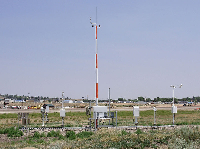 Image source: Famartin, CC BY-SA 3.0, via Wikimedia Commons
Weather experts look at the thermometer reading on the ground and the wetness of the air near the ground. They also look at any changes in what kind of precipitation is falling as seen by people on the ground. Weather data analysis helps to check and improve the rain or snow forecast based on the analysis of the temperature at various heights.
Meteorologists also use weather radars that can tell the difference between rainfall, snowfall, and mixed precipitation:
- Rain. Rain usually shows up as areas of even or smooth signals on the radar screen.
- Mixed rain and snow. When there is both rain and snow in the same place, the radar can show mixed signs of rain and snow signals.
- Snow. Snow typically makes weaker radar signals than rain. Radar signals from snowfall may be more uneven and change more because of the different sizes and shapes of snowflakes.
Weather satellites also help by taking pictures and data from space to watch clouds, storms, and thermal level changes over big areas. By looking at these pictures, experts can figure out what types of clouds are making rain or snow and watch how the clouds change over time.
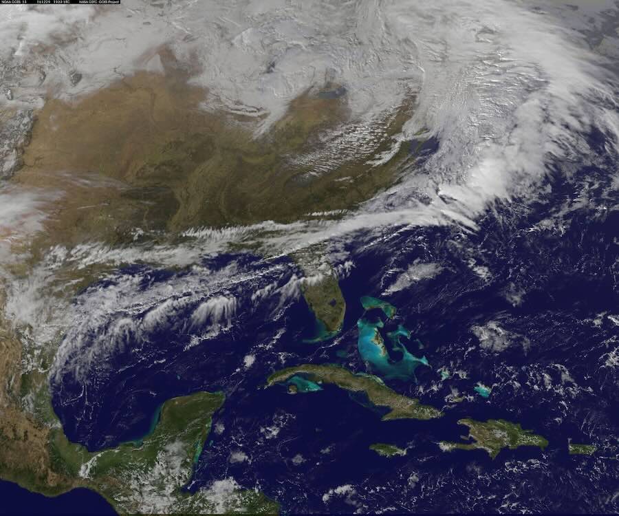 Image source: NASA
The water in a cloud and the presence of ice particles in it affect the appearance of clouds, their formation, and the nature of precipitation. The type of cloud determines the amount of water in it. For example, storm clouds have the greatest amount of water whereas layered rain clouds have 3 times less.
To see what the atmosphere is like at different heights, meteorologists send up weather balloons with radiosondes. These devices measure temperature, humidity, and wind at various levels, giving a complete view of the atmospheric conditions.
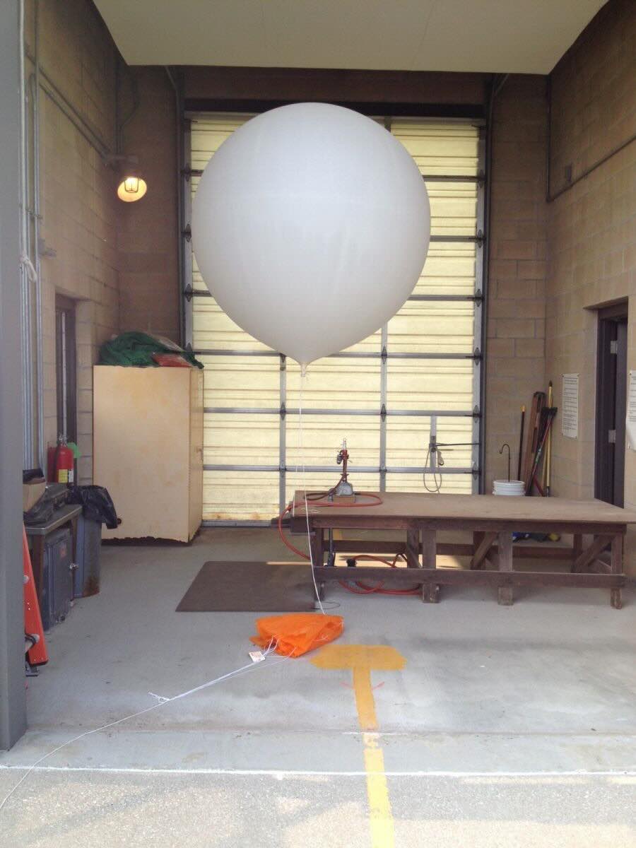 Image source: National Weather Service
Weather Prediction Models
Next, meteorologists use advanced computer models that try to mimic the behavior of the atmosphere by using math and data from numerous sources. These models show them the current weather conditions and use science to guess how the weather will change over time.
Weather models help meteorologists understand how different things in the atmosphere affect each other and make forecasts for the next hours, days, and even weeks. But they are not always right. The atmosphere is very complicated, and small mistakes in data or guesses can make big differences in meteorological predictions.
Precipitation Types
Distinguishing precipitation types is important because they have different effects and happen under various conditions. The main parameters that meteorologists use to predict rain and snow as well as tell them apart are temperature, freezing level, melting layer, and ground temperature.
Temperature Profile and Freezing Level
Thermometer readings are quite important in defining the type of precipitation. The height above the ground where the temperature becomes freezing is called the freezing level. Sometimes this level can be identified by weather radars. In the image below, it appears as the yellow ring around the radar.
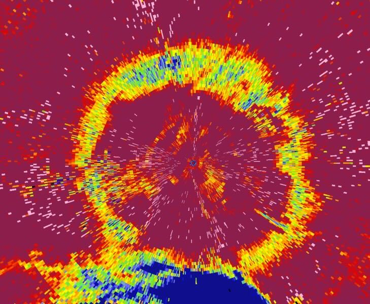 Image source: Bryan C. W., CC BY-SA 4.0, via Wikimedia Commons
When the thermal level throughout the entire atmospheric column, from the cloud base to the surface, is above freezing (32°F or 0°C), precipitation falls as rain. When the temperature is below freezing in the entire atmosphere, meteorologists expect snowfall. Changes in temperature at different levels can lead to a mix of rain, snow, or sleet.
| Temperature | Precipitation Type |
|---|---|
| <32°F or 0°C | Rain |
| >32°F or 0°C | Snow |
| Temperature varies | Mixed |
Melting Layer
Meteorologists look at the up-and-down view of temperature and humidity to see how thermal level changes with height in the atmosphere. A careful look at this view helps them guess the chances of rain or snow.
Sometimes there is a warm layer between two cold layers in the atmosphere. This area, which is called the melting layer, is important when snowflakes partly melt and become raindrops. How thick this layer is and how fast the temperature changes in it determine if the precipitation will be mostly rain or snow. If it is cold on the ground but there is a warm layer above, there may be a risk of freezing rain.
 Image source: Wikipedia
Ground Temperature
The thermometer reading of a surface that precipitation falls on also matters in defining the precipitation type. If it is warm on the ground, snow may melt and become rain before reaching the ground. If it is cold on the ground, the precipitation is more likely to fall as snow.
Conclusion
Weather forecasting is a challenging and multifaceted science. Meteorologists harness the power of technology, data, and their own knowledge to predict when it will rain or snow and to distinguish between precipitation types. By analyzing weather patterns such as temperature, freezing levels, melting layers, and ground conditions, they put together a comprehensive picture of the weather ahead.