York Hurricane Tracking Map
Rain
- Overcast
- Drizzle
- Light rain
- Moderate rain
- Shower
- Hail
Snow
- Light theme
- Moderate
- Heavy
Tropical storms are areas of extremely low pressure on the earth’s surface. A tropical storm with a wind speed greater than 73 mph belongs to the category of hurricanes. Strong hurricanes of category 2 and higher can cause natural disasters and damage. Therefore, it is crucial to recognize them beforehand and keep the situation under control. A live map of these natural phenomena would help to detect hurricane evacuation zones, warn about a disaster such as flooding, and contribute to public safety.
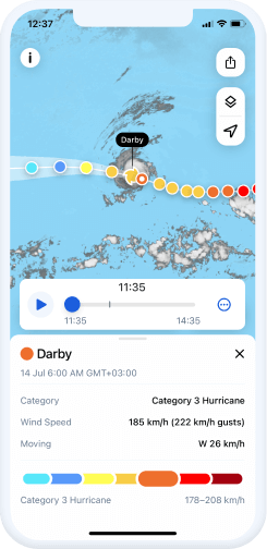
Our hurricane radar page allows you to track the movement of hurricanes and tropical storms on the map. To find out where the actual storm is currently moving, click the icon in the upper-right corner of the map. You will see chains of colorful dots forming the past, current, and predicted path of a hurricane, cyclone, or tropical storm. The movement area forecast predicts a zone where a cyclone can go with the most probable path in the center of the zone.
Different types of tropical storms are marked with different colors on the map:
- Tropical Depression (<38 mph)
- Tropical Storm (39-73 mph)
- Category 1 Hurricane (74-95 mph)
- Category 2 Hurricane (96-110 mph)
- Category 3 Hurricane (111-129 mph)
- Category 4 Hurricane (130-156 mph)
- Category 5 Hurricane (157 mph or higher)
Active Hurricanes for York
In the table below, you can find helpful information about the hurricanes that are currently active and then follow their tracks on our map.
| Name | Category | wind speed | moving |
|---|
More in app
In the Rain Viewer app, you can view more details about the upcoming hurricanes, cyclones, and tropical storms with the following key features:
Extended storm information
You can tap each point of the tropical storm path and view details about it, such as category, wind speed (including a possible storm surge), and movement speed.

Push notifications
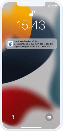
We send timely notifications via the app in the event of a hurricane that is near your city or region. As a result, you have enough time to evacuate and get further assistance, if necessary.

Quick settings
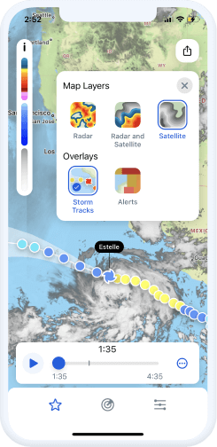
You can quickly turn the storm tracks on and off in quick settings directly on the map, together with many other layers, such as satellite data, radar coverage, severe weather zones, etc.


