The 2024 hurricane season lasted from June 1 to November 30 in the Atlantic and from May 15 to November 30 in the Pacific. The season demonstrated contrasting activity in the Atlantic and Pacific basins, shaped by El Niño conditions and other atmospheric factors.
The Atlantic saw an above-average season, with 18 named storms, 11 hurricanes, and five major hurricanes (with peak intensity starting from Category 3). Meanwhile, the Pacific experienced a quieter season, with fewer storms overall. This matched the 2024 hurricane season outlook by NOAA and the National Hurricane Center.
In this blog post, we will review the season’s hurricane activity and major tropical cyclones for both basins.
2024 Atlantic Hurricane Season
The Atlantic basin saw 11 hurricanes:
| Name | Dates | Max. Category |
|---|---|---|
| Beryl | Jun 28 – Jul 9 | 5 |
| Debby | Aug 3-9 | 1 |
| Ernesto | Aug 12-20 | 2 |
| Francine | Sep 9-12 | 2 |
| Helene | Sep 24-27 | 4 |
| Isaac | Sep 26-30 | 2 |
| Kirk | Sep 29 - Oct 7 | 4 |
| Leslie | Oct 2-12 | 2 |
| Milton | Oct 5-10 | 5 |
| Oscar | Oct 19-22 | 1 |
| Rafael | Nov 4-10 | 3 |
Two of these hurricanes, Isaac and Leslie, were “fish storms”, meaning that they did not make landfall and remained over the water.
The major hurricanes of the Atlantic hurricane season were:
- Beryl (Cat.5)
- Helene (Cat.4)
- Kirk (Cat.4)
- Milton (Cat.5)
- Rafael (Cat.3)
Now let’s take a more detailed look at each of these 5 tropical cyclones.
Hurricane Beryl
Beryl marked an intense start to the Atlantic hurricane season, breaking records as the earliest Category 5 hurricane in the basin’s history. Initially forming on June 28 as a tropical depression in the central Atlantic, Beryl rapidly intensified. By July 1, it achieved Category 4 hurricane strength with wind speeds of 150 mph (241 km/h) as it made landfall on Carriacou Island. By July 2, Beryl reached its peak intensity as a Category 5 hurricane with sustained winds of 165 mph (265 km/h), fueled by abnormally warm ocean temperatures.
The storm caused catastrophic damage across the Windward Islands, with widespread destruction of infrastructure and housing in places like Union Island. As it moved through the Caribbean sea and into the Gulf of Mexico, Beryl weakened but remained dangerous. On July 1, it made landfall near Matagorda, Texas, as a Category 1 hurricane. The storm brought heavy rains exceeding 14 inches (355 mm) in parts of Texas and generated a historic tornado outbreak across the southern U.S.
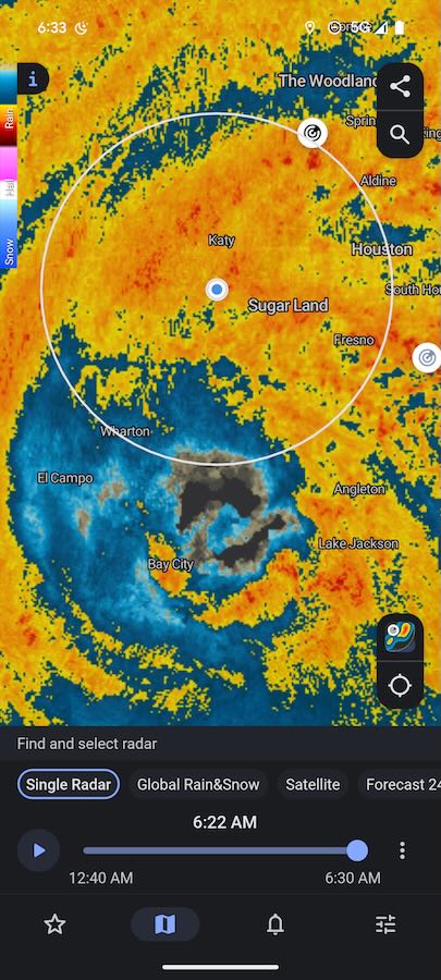 Source: Rain Viewer app
Read an article about how Oleksii, CEO of Rain Viewer, experienced the impact of Hurricane Beryl in Texas: Inside Hurricane Beryl: The Story of an Eyewitness
Hurricane Helene
Hurricane Helene was a powerful and destructive storm that left a significant impact across the southeastern United States. Originating in the western Caribbean on September 22, the storm rapidly intensified as it moved into the Gulf of Mexico. It became a Category 4 hurricane just before landfall in Florida’s Big Bend region near Perry on September 27. Helene had sustained winds of 140 mph (225 km/h) and a record storm surge of over 15 feet (4.5 meters). It caused catastrophic flooding and widespread damage to homes and infrastructure in coastal areas.
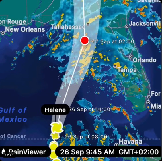
As Helene moved inland, it weakened to a tropical storm but unleashed torrential rain across Georgia and the Appalachian region. Western North Carolina saw rainfall exceeding 30 inches (762 mm) in some areas, leading to severe flooding, landslides, and damage to roads and utilities. The storm caused significant environmental and wildlife impacts, including disrupted habitats and stranded animals.
Helene resulted in more than 230 verified fatalities across six states and left thousands displaced.
Hurricane Kirk
Hurricane Kirk began as a tropical storm on October 1st and quickly intensified into a hurricane. Throughout its development, it reached Category 4 strength on October 3rd, with sustained winds of 145 mph (230 km/h). Initially, Kirk threatened the Atlantic Ocean, generating significant swells along the U.S. East Coast. However, its trajectory shifted, and the storm moved northwestward across the central Atlantic.
By October 4th, Kirk weakened slightly but maintained its major hurricane status. As it approached Europe, the storm transitioned into a powerful extratropical system. It caused severe weather across parts of Portugal and Spain, particularly in the northern regions. High winds, rain, and significant coastal damage ensued, including uprooted trees, damaged vehicles, and power outages. In Spain, landslides and fallen trees disrupted transportation, while hurricane-force winds caused structural damage in several regions.
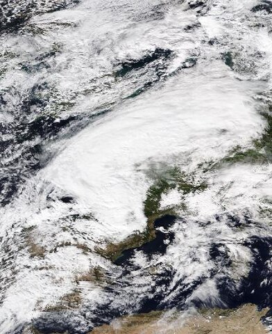 Source: WeatherFollower, CC BY-SA 4.0, via Wikimedia Commons
Hurricane Milton
Milton was the strongest tropical cyclone worldwide and the strongest hurricane of 2024. On October 7, it rapidly intensified into a Category 5 hurricane, fueled by warm Gulf of Mexico waters. Within 24 hours, it surged from a tropical storm to its peak intensity, with winds reaching 180 mph (290 km/h). This made it one of the most intense hurricanes on record. However, Milton’s strength was short-lived as it encountered wind shear over the Atlantic basin, causing it to weaken slightly before landfall. On October 9, the hurricane struck near Siesta Key, Florida, as a Category 3 hurricane with winds of 120 mph (193 km/h). Despite weakening, it retained significant power as it moved across the state, causing extensive damage.
The storm produced severe flooding, widespread power outages, and a catastrophic tornado outbreak, including several EF3 tornadoes. The tornadoes caused substantial destruction, particularly in St. Lucie County, where six fatalities occurred. Milton’s heavy rains led to local flooding, with some areas receiving more than 20 inches (508 mm) of rain. The storm also caused significant storm surge damage along the Gulf Coast. Milton’s rapid intensification, storm surge, and tornadoes left a trail of devastation across Florida, and recovery efforts continued in the weeks following the storm.
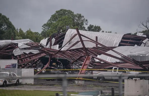 Source: TCPalm
Hurricane Rafael
Having formed on November 4, 2024 as a low-pressure system in the Caribbean, Hurricane Rafael rapidly intensified into a major Category 3 hurricane by November 6. The storm made landfall on Cuba’s western coast, causing significant damage and widespread evacuations, especially in Havana. Rafael then tracked into the Gulf of Mexico, weakening but still bringing life-threatening surf conditions along the southeastern U.S. coast. The hurricane was notable for its rare strength in November, being the first major storm in the Gulf that month in nearly 40 years. It caused extensive flooding and infrastructure damage, especially in Cuba, and resulted in fatalities in Panama and Jamaica.
2024 Pacific Hurricane Season
The Pacific saw the following major hurricanes:
- Gilma (Cat.4)
- John (Cat.3)
- Kristy (Cat.5)
Two of them were “fish storms” and did not make landfall.
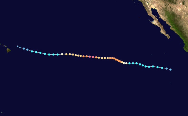
Hurricane Gilma
Hurricane Gilma formed on August 18 and rapidly intensified over the following days. It reached its peak strength as a Category 4 hurricane on August 25, with maximum winds of 130 mph (210 km/h). During its course, Gilma strengthened further and maintained a robust presence in the eastern Pacific before gradually weakening by early September. Although it stayed far from land, Gilma brought strong winds and heavy rain to open ocean areas.
The storm didn’t make landfall, but it quickly intensified, causing major ocean disturbances and dangerous conditions for ships. Gilma’s damage potential was high due to its size and power, though no direct impact on coastal regions occurred. By August 30, Gilma had weakened to a tropical storm as it drifted further away from land.
 Source: Wikipedia
Hurricane John
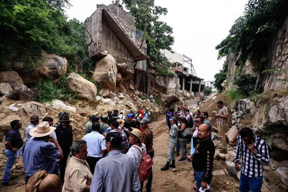
Hurricane John, a powerful storm that made landfall in late September 2024, began as a tropical storm before intensifying to a Category 3 hurricane. It initially hit the Pacific coast of Mexico on September 24, with major impacts in the states of Guerrero, Oaxaca, and Michoacán. As it moved slowly along the coast, it caused extreme rainfall and significant flooding, with some areas receiving more than 10 inches (250 mm).
John’s path led to widespread destruction, particularly in Acapulco, Guerrero, where rivers overflowed, roads and bridges were damaged, and entire neighborhoods were flooded. Affected areas faced severe power outages, business closures, and road blockages. As the storm continued, it weakened but continued to bring heavy rains that led to mudslides and further isolated communities, particularly in Oaxaca.
 Source: EFE/ David Guzman
The death toll from the storm reached at least 29 people. John’s devastation was compounded by the region’s already slow recovery from the eastern Pacific Hurricane Otis, which struck the area in 2023. The Mexican government mobilized thousands of rescue workers and emergency responders to provide aid and restore services in the affected regions.
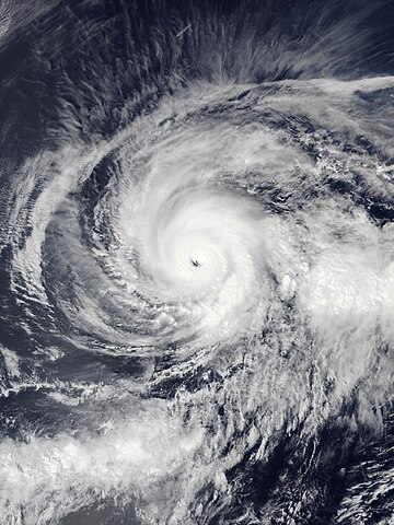
Hurricane Kristy
Hurricane Kristy formed in late October 2024, originating off the southwestern coast of Mexico. It initially intensified as a Category 1 storm, having rapidly strengthened to a powerful Category 4 hurricane by October 24. Kristy reached its peak with maximum sustained winds of 155 mph (250 km/h) on October 24 and 25, causing significant concerns for coastal regions. As it moved westward over the Pacific Ocean, Kristy generated hazardous swells along the western coast of the Baja California Peninsula. However, no coastal watches or warnings were issued as it remained offshore.
Despite its strength, Kristy did not make landfall, and its impact was primarily confined to the open ocean. The storm weakened quickly after peaking, transitioning from a major hurricane to a Category 2 system as it continued to move west-northwest. While the storm caused some disruption, its primary hazard was the dangerous ocean conditions rather than direct damage to land.
 Source: Wikipedia
Final Thoughts
The 2024 season highlights the dynamic nature of tropical cyclones and the critical need for preparedness, even during predicted “below-average” seasons. As in the forecast, the Atlantic was active, but quieter conditions in the Pacific still posed challenges, especially for coastal communities. Staying vigilant and informed remains the best defense against these powerful natural phenomena.


